It's been three years since our last cruise on the Okeechobee Waterway and this time we planned to do it a little differently. On our last crossing of the Lake, we took the direct route across or what is also known as Route 1. This time we planned to take Route 2, or the rim route as we traveled east to west. This trip was also work, since it was the beginning of our research for our fourth book in
The Great Book Of Anchorage series and will cover the Okeechobee Waterway and the Gulf Coast from Cape Sable, FL to Mobile, AL. Most folks avoid the rim route because of the reputation for shallow water, but we know a little secret that will allow even deeper draft boats to use the rim route in all but extreme low water levels. Prior to any Lake crossing there are three things a boaters wants to know before starting at either the east or west end of the OWW. There is one place to find two pieces of the info you need and that is on the Corps of Engineers website - the lake level and lock restrictions. The third is weather information - the National Weather Service website for Lake Okeechobee can be
found here.
Lake Okeechobee is a very large and shallow lake. A strong to moderate wind can develop a nasty chop and make crossing a very uncomfortable situation. The current lake levels are important for a boater to have to safely cross the Lake and that information can be found by
clicking the link here. The page is updated daily, gives the overall Lake level and the lowest depths for the Route 1 or Route 2 crossing. The depths given are not the depths for the entire crossing but the shallowest depths anywhere along the route. It's important to know where those lower depths might be found to avoid running aground. There will be much more water on 98% of the trip than the lowest levels reported. The second thing a boater will want to know is if there are any delays or changes in the schedules of the five locks that have to be transited along the OWW. That information can be found by
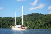
clicking the link here. Then the trip can begin and it's a trip we highly recommend. There is one other piece of information that is important to sailors. There is a height restriction that will keep sailboats with masts higher than 49 feet from using the waterway. Those boats with taller masts will have to go down the ICW and around through the Keys to get to the opposite coast.

The shallow areas can be found in two locations. If crossing directly across the lake, shallow sections are in the channel as you approach Clewiston. There is no way around this spot, so close attention to staying in the channel and your draft in comparison to lake levels is important. But the rim route offers an opportunity to cheat a little and avoid not only the shallow area crossing the lake, but the shallow area along the rim route. This might seem odd since the reported depths for the rim route are always substantially lower than route 1. But there is only a very short section of the rim route where this shallow water can be found and it is easy to bypass. Immediately after existing the Port Mayaca Lock, the marked channel for the rim route turns south. There the depths can be as little as 4 to 5 feet. Instead of turning into the channel, take a course straight out into the lake until the depth finder reads 9 to 10 feet. Turn south and head toward R "60" at Statute Mile 50 near Pahokee and depths will be at least 9 feet all the way. This is depends on the overall lake levels. If levels are normal, these are the average depths. Re-enter the rim route channel and except for a small section with 8 to 9 feet, depths from 12 to 20 feet can be found almost the entire way.

The rim route is much more interesting and offers the opportunity to find some excellent anchorages along the way. At Torry Island, near Statute Mile 61, there is a swing bridge that requires the bridge tender to walk out on the bridge and use a bar to turn the mechanism by hand which allows the bridge to be opened. Shortly past the bridge we found a fantastic anchorage in a kidney bean shaped basin known as South Bay with all-around protection. We shared the anchorage with a few fisherman that went home for the evening and several large gators that hung around all night. From there it was a short distance to Moore Haven and the first lock on the west side of the lake. In the small town of Moore Haven, there is an anchorage just before the lock in the old channel or a very inexpensive town marina on the canal right after the lock. From this point on westward, you are in the Caloosahatchee waterway system. After another 20 miles, the Ortona Lock is the next to be negotiated. Each of the locks are easy to transit. There are signs to announce the arrival point. From there a call to the Locktender on the VHF radio is required and you will get locking instructions. Once a green light appears at the lock entrance, you enter the lock and lines are dropped down to secure the bow and stern of the boat. The water is lowered or raised, depending on which direction you're going, and once the appropriate level is reached, the gates are opened and the boat is free to exit.

About 8 miles west of Ortona is the
town of La Belle. The town has constructed docks adjoining the canal and they are free to boaters for a maximum of three days. There is power and water on the docks, also free, but the boat needs to be tied up so that you will be able to get off either on the bow or the stern. There are no finger piers, except two small ones with water depths of only a foot or two and no power or water. In the downtown area there is a restaurant, coffee house, playhouse, pizza shop and groceries, and other restaurants are only a short walk. The docks are first come, first served and during the busy season, can be full. At the time we were there, they were having problems with the power and it was not available at all of the slips. Someone from the city did come down to work on them and told us this has been an ongoing issue.

Beyond La Belle, the Caloosahatchee canal and river winds through residential and farm land. It's not unusual to see cows and horses standing along the banks watching your boat go by. At Statute Mile 122, we encountered the final lock westbound, WP Franklin Lock. Approaching the lock from the east, a basin on the north side leads to the docks at the
marina and campground. Just as the marina at St. Lucie Lock,
Franklin is part of the National Parks and offers the same $24.00 per night or $12.00 with a senior pass. This includes electric and power and is good for a maximum of two weeks. This would be our next and final stop on the Okeechobee Waterway before reaching Ft. Myers. A nagging oil leak on the front of the engine was getting progressively worse so a stop for repairs would be needed. We had already contacted a mechanic in the area and ordered the needed parts from
American Diesel. The parts would arrive at the downtown marina about the same time that we would arrive. For now we planned to just enjoy the park at Franklin Lock.
For additional information on the Okeechobee Waterway, see our previous posts...
http://trawler-beach-house.blogspot.com/2010/09/okeechobee-waterway.html
http://trawler-beach-house.blogspot.com/2011/06/photo-tour-of-okeechobee-waterway.html
http://trawler-beach-house.blogspot.com/2011/05/titusville-to-big-lake.html


No comments:
Post a Comment
Note: Only a member of this blog may post a comment.